
Mount Athabasca Alpine Climb
- Viewed - 13
Gallery / Photos


Level:
Time/Dist
Elevation Gain
Description
Trailhead: Mount Athabasca is located near the Columbia Icefields, 100kms south of Jasper approximately 111kms north of Lake Louise. Directly in front of the Icefields Centre. Jasper National Park.
Description: Mount Athabasca (3,491m) is not a day hike but a mountaineering objective that requires technical knowledge of glacier travel, crevasse rescue and climbing techniques. Route evaluation shows that climbing Mt Athabasca via the west side (AA col) is becoming increasingly popular due to less objective hazard than the popular northern glacier approach routes. The AA col approach is generally shaded until early afternoon which makes for great snow conditions and less avalanche danger.
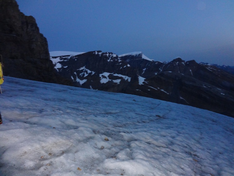
After an early alpine start (2:30am) we parked at the Mt Athabasca climbers parking lot and geared up for the day. (The bus gate is usually left open in the early morning for climbers) A registry box is there to sign in with your party and it’s route objective and is recommended that you don’t forget to check back in at the end of your trip for obvious reasons.
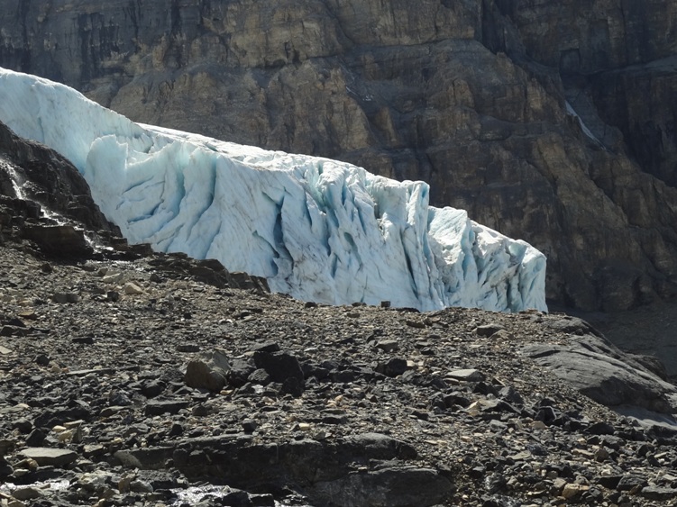
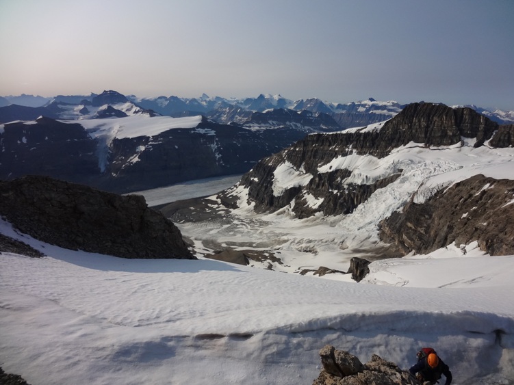
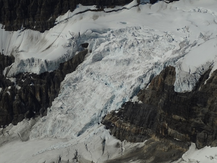
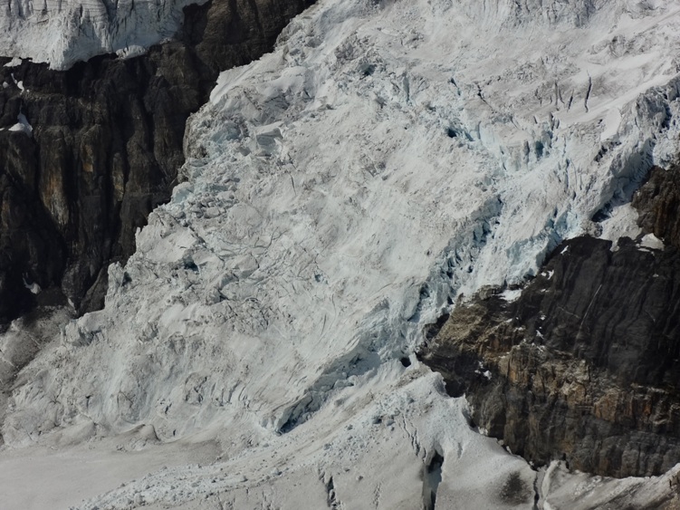
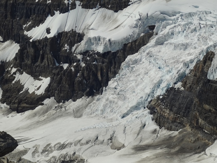
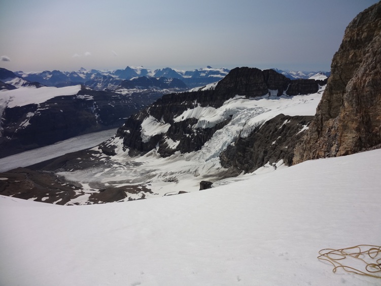
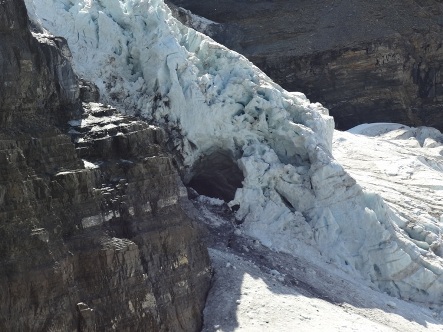
From the parking lot hike up the bus road until you reach the snow coach parking area where you will find a trail leading up through moraines on your immediate left. Follow this trail (sometimes obscured) up and around Athabasca’s west buttress which leads to the Athabasca, Andromeda Col (AA col). The AA glacier and icefall will be on your right but will most likely go unnoticed because of the time of day.
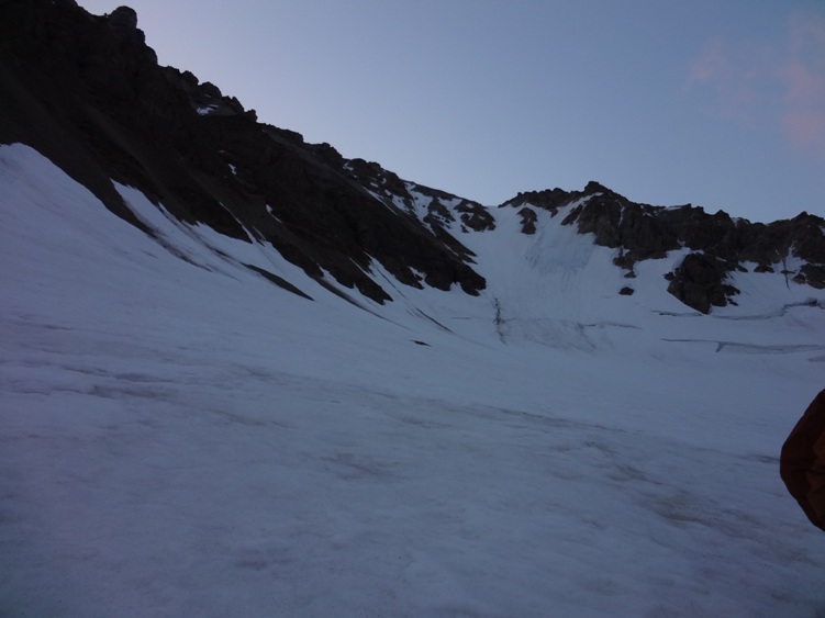
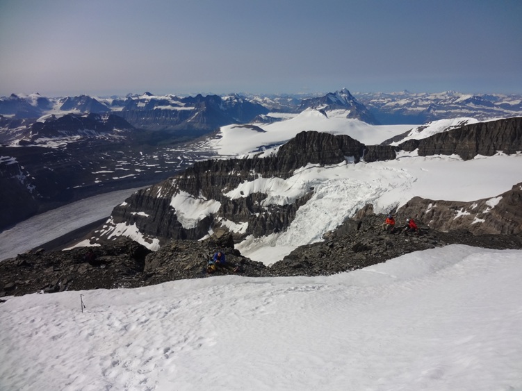
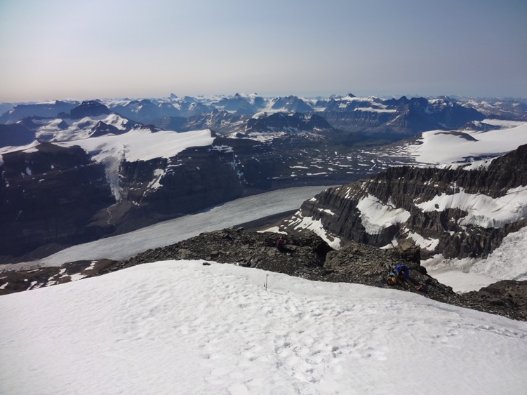
Following the trail, work your way up the moraines until a small headwall is reached where some scrambling is required. Climbing here is short and straight forward but be cautious of kicking rocks down on your group as well as keep in mind the possibility of rock fall from the cliffs above. This is not a place you would want to stop for very long. Shortly after the headwall you will reach the AA glacier situated above the icefall and here is where we geared up for glacier travel.
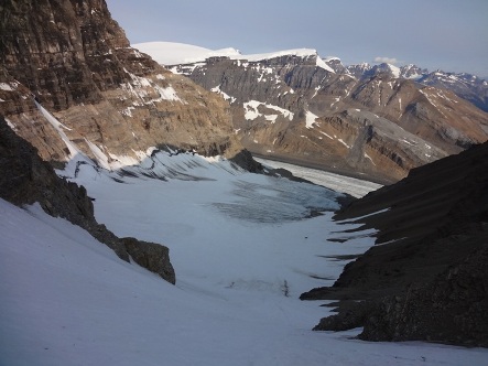
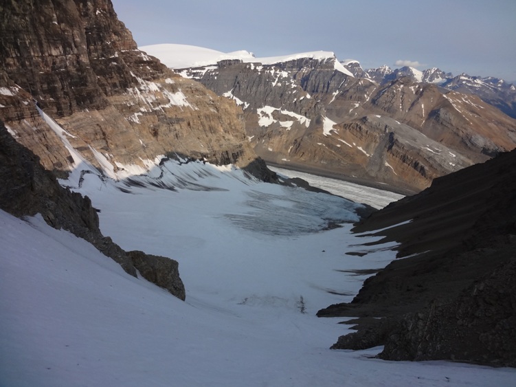
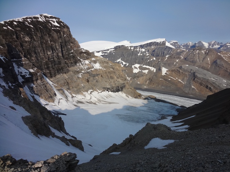
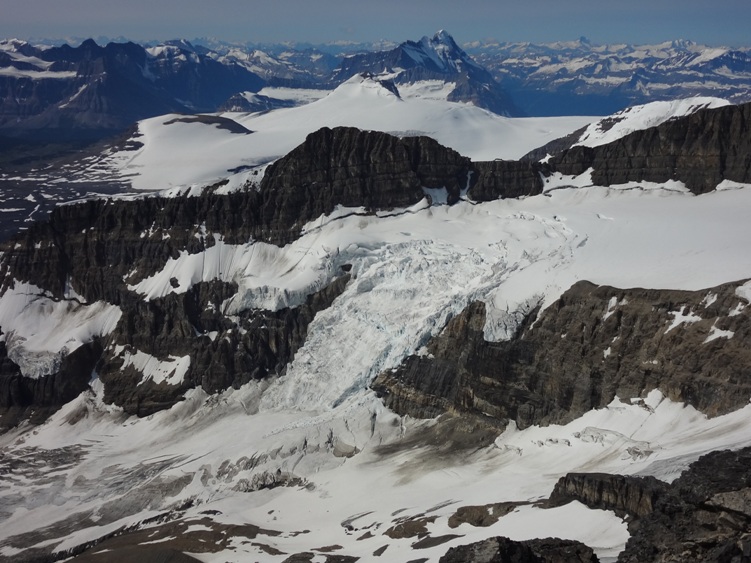
Work your way up the glacier on easy terrain keeping an eye out for potential crevasses. We climbed left of center towards Athabasca’s snow slopes left of the AA col and had to jump over several small crevasses. Once passed the bergschrund we kiwi coiled our ropes and headed up the slope. The first section of the slope was a moderate snow climb of 30-40 degrees but the last 60m or so was a steeper 45+. Some parties choose to pitch the last (or entire) section with protection but different conditions would call for different techniques. Once atop the slope, it’s a good spot to hydrate and nourish while also taking off your crampons and ropes (conditions permitting).
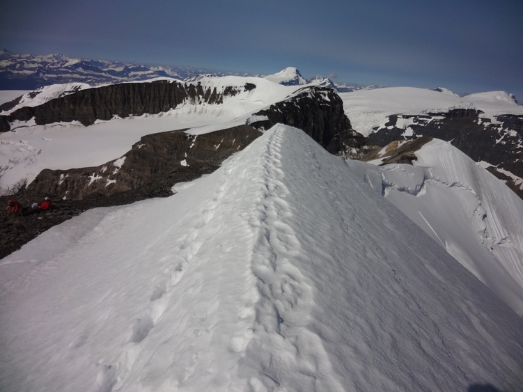
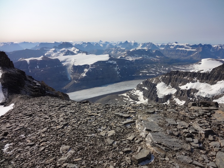
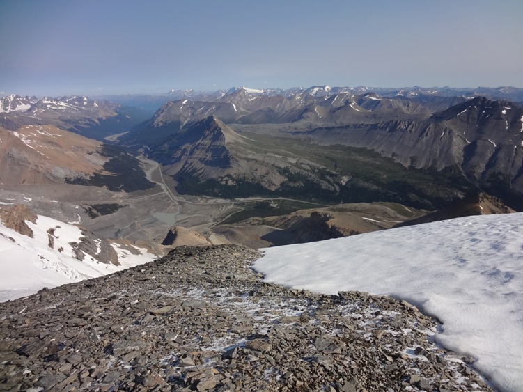
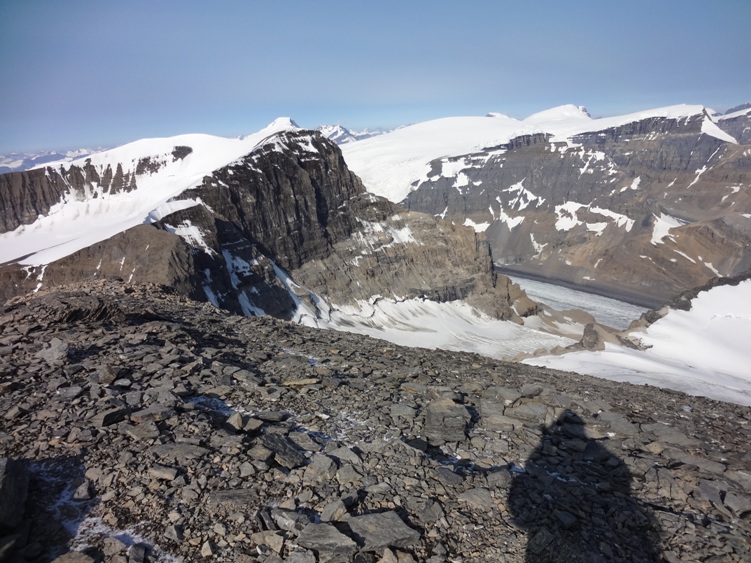
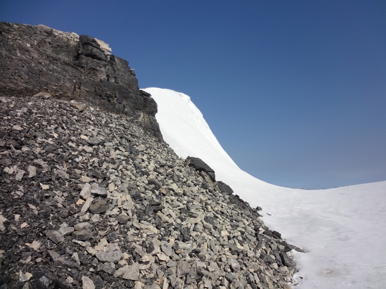
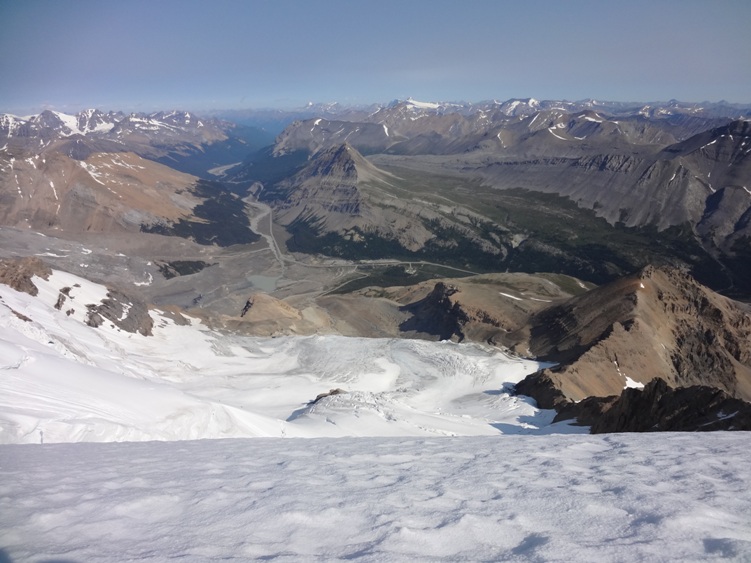
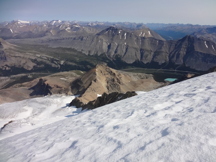
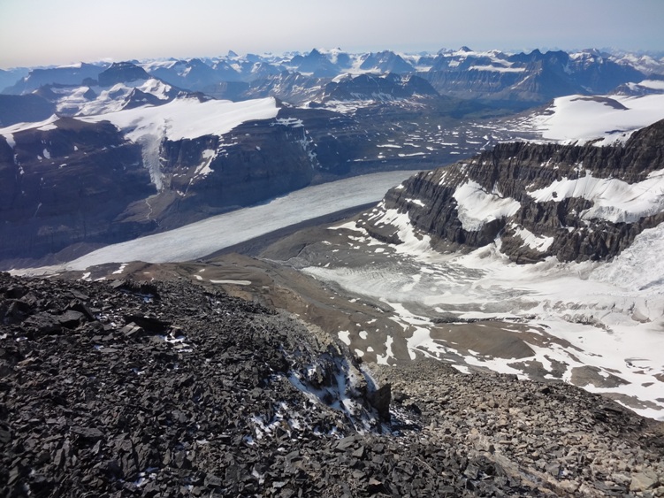
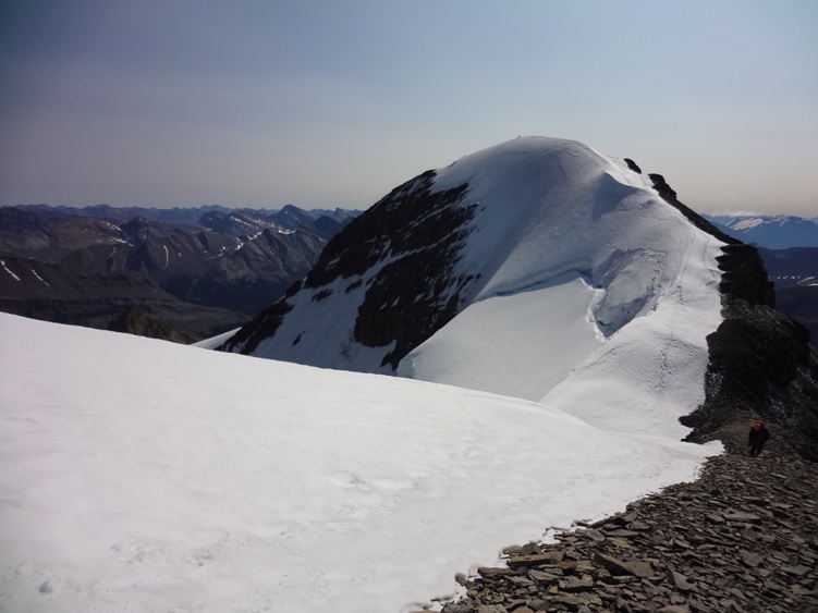
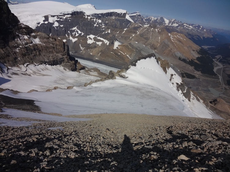
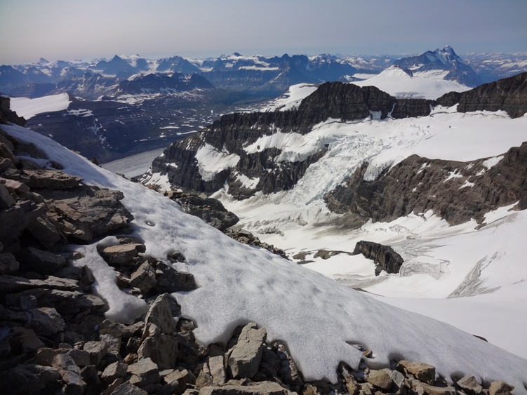
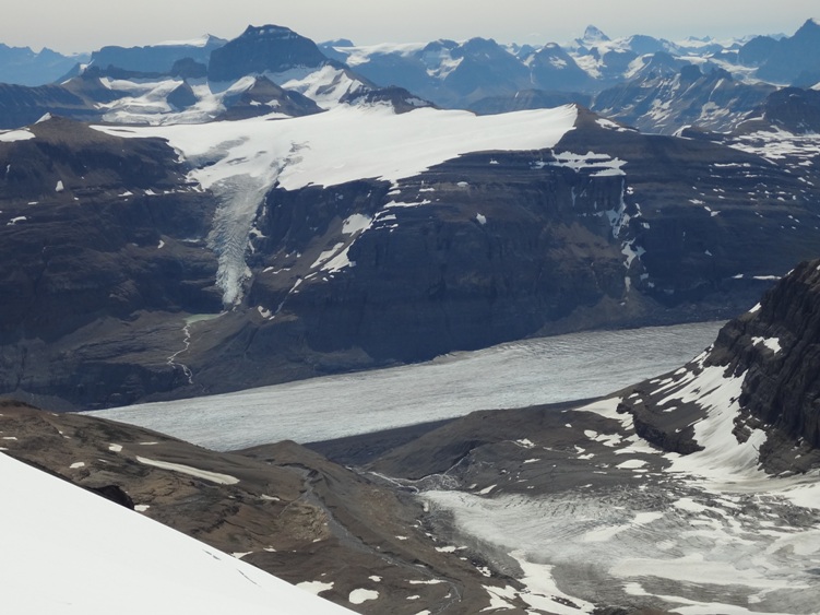
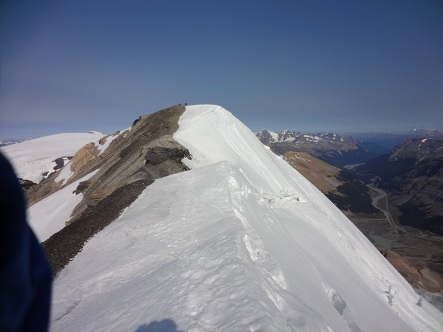
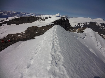
The summit ridge is in view to your left. After a hundred or so yards of hiking along the ridge you will reach the silver horn which is bypassed on the climbers right, the horn offers a large snow drift for shelter where we once again geared up with ropes and crampons for the summit push. During the final 60 yards of the summit ridge, Athabasca’s north face routes will be visible down your left while views of the Saskatchewan glacier, Mts. Castleguard and Andromeda will be on your right. Directly behind you is Snowdome, Mt. Kichener, the Twins and Mount Columbia off in the distance. If you have the weather on your side, the views will certainly be something to remember. Photo’s below were taken in early August.
Items Reviewed - 1
One of the best Alpine Climbs in the Canadian Rockies.


Add Review